Greed, a lack of foresight and an unexpected severe storm nearly destroyed a small town in Maryland... twice!
Back in a former life I lived in a small town in Maryland called Ellicott City. One of the coolest little artsy towns in the state with cute little shops in cubbies between buildings or on 3rd floors of narrow, vertical row houses. You couldn't get lost. Ellicott City WAS Main St. That's it. It was cut into a tiny valley between two steep hillsides. There were only a couple roads that veered off into their respective neighborhoods. We'll get to that in a moment because that was the problem.
The Patapsco River rushes down the canyon next to Oella Avenue. Oella ends and Ellicott City begins where it bottoms out. Here, the Patapsco takes a sharp left under a bridge and continues on its way towards the south. Ellicott City continues up the other side of the valley for about 3/4 mile. One look at the Patapsco and its 90� left turn and you think, "this is a flood zone". And it is. Hurricane Agnus, back in 1972 when I was just a wee lad turned the lower portion of Ellicott City into a lake.
But that's a consequence of nature. What I'll be talking about here is a consequence of man and an ideal example of climate change, in one square mile.
Ellicott City is not that big. You can walk the entire length of the town, up and back within 1/2 hour. It's length, and the newer neighborhoods that spread out on the sides are less than one square mile. Those newer neighborhoods were built somewhere around 2010 (I think). Home developers came in and said "this is such an artsy and quaint little town... we need to build a neighborhood on that hill above it"!
So they did. They cut down acres of trees. They landscaped and paved and built their neighborhood. They didn't consider the consequences. They didn't model out weather scenarios. They just put in what they wanted.
There are two roads into that neighborhood from Main Street. One of them climbs steeply just about half way up the valley. This road, Church Road is now lined with houses.

The red line covers the area that was build out with the exception of the courthouse area. But that was renovated in the past 12 years and expanded. Many of the houses on Church Road were also built in the last dozen years or so. What you don't see here is the topography. The incline of Church Rd may reach 15� as it first climbs from Main St.
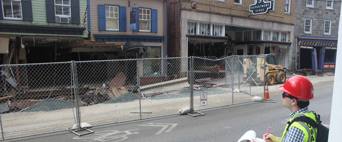
The loss of forest coverage meant less ability to contain water, and that turned into a disaster in 2016... and again in 2018. The 2018 storm dumped about 8" of rain in just a few hours. Below is what Main street looked like during that flood. 8" of rain would have definitely flooded the town, but loss of absorption on that hill turned flooding into almost complete destruction.
The rain didn't soak in. Church Road just turned into a river which ran straight into Main Street.
As you can see from the video below, the damage was catastrophic. (article in the summary) This happened twice in a span of 2 years, and both people and businesses started moving away after these floods. Developers destroyed both the physical and spiritual character of the town.
This is an example of climate change in one square mile. The callousness and greed of businesses who do not care about anything but their own pockets. What happened here is happening on a planetary scale and it is now out of our control.